Breckenridge, Colorado
| Town of Breckenridge, Colorado | |
|---|---|
| — Town — | |
 |
|
| Coordinates: | |
| Country | |
| State | |
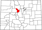
| County | Summit County Seat[1] |
| Established | November 1859 as Breckinridge |
| Incorporated | 1880-03-03[2] |
| Government | |
| - Type | Home Rule Municipality[1] |
| - Mayor | Dr. John Warner |
| Area | |
| - Total | 5.0 sq mi (12.8 km2) |
| - Land | 5.0 sq mi (12.8 km2) |
| - Water | 0.0 sq mi (0 km2) |
| Elevation | 9,600 ft (2,926 m) |
| Population (2000) | |
| - Total | 2,408 |
| - Density | 486.4/sq mi (187.8/km2) |
| Time zone | MST (UTC-7) |
| - Summer (DST) | MDT (UTC-6) |
| ZIP code | 80424[3] |
| Area code(s) | 970 |
| FIPS code | 08-08400 |
| GNIS feature ID | 0204681 |
| Website | Town of Breckenridge |
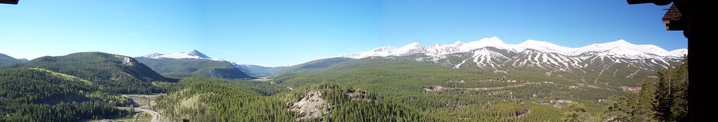
Established in 1859, the historic Town of Breckenridge is a Home Rule Municipality that is the county seat of Summit County, Colorado, United States.[4] As of the 2000 Census, the town had a population of 2,408. The town also has many part-time residents, as many people have vacation homes in the area. Breckenridge is also a popular ski resort during the winter months, servicing multi-difficulty ski slopes on the Rocky Mountains. Summer in Breckenridge attracts outdoor enthusiasts with hiking trails, wildflowers, fly-fishing in the Blue River, mountain biking, nearby Lake Dillon for boating, white water rafting, alpine slides, and several shops up and down Main Street. Every year, Breckenridge hosts the Breckenridge Festival of Film, established in 1981, as well as an annual Fourth of July parade.[5] Breckenridge has recently passed a law legalizing the possession of up to one ounce of cannabis for adults.[6]
Contents |
The name Breckenridge
The town of Breckenridge was formally created in November 1859 by General George E. Spencer. Spencer chose the name "Breckinridge" after John C. Breckinridge of Kentucky, Vice President of the United States, in the hopes of flattering the government and gaining a post office. Spencer succeeded in his plan and a post office was built in Breckinridge; it was the first post office between the Continental Divide and Salt Lake City, Utah.
However, when the Civil War broke out in 1861, the 40-year-old former vice president sided with the Confederates (as a brigadier general) and the pro-Union citizens of Breckinridge decided to change the town's name. The first i was changed to an e, and the town's name has been spelled Breckenridge ever since.[7]
History
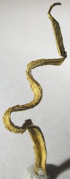
Prospectors entered what is now Summit County (then part of Utah Territory) during the Pikes Peak Gold Rush of 1859, soon after the placer gold discoveries farther east at Idaho Springs. Breckenridge was founded to serve the miners working rich placer gold deposits discovered along the Blue River. Placer gold mining was soon joined by hard rock mining, as prospectors followed the gold to its source veins in the hills. Gold in some upper gravel benches north of the Blue River was recovered by hydraulic mining. Gold production decreased in the late 1800s, but revived in 1908 by gold dredging operations along the Blue River and Swan River. The Breckenridge mining district is credited with production of about one million troy ounces (about 31,000 kilograms) of gold.[8] The gold mines around Breckenridge are all shut down, although some are open to tourist visits. The characteristic gravel ridges left by the gold dredges can still be seen along the Blue River and Snake River, and the remains of a dredge are still afloat in a pond off the Swan River.
Notable among the early prospectors was Edwin Carter - Log Cabin Naturalist who decided to switch from mining to collecting wildlife specimens. His log cabin built in 1875 exists today and has been recently renovated by the Breckenridge Heritage Alliance with interactive exhibits and a small viewing room with a short creative film on his life and the early days around Breckenridge.
Breckenridge was the film location of the 1989 comedy National Lampoon's Christmas Vacation and some scenes in Dumb and Dumber (shots of Aspen in the movie are actually Breckenridge)
On November 3, 2009 voters passed ballot measure 2F by a nearly 3 to 1 margin (73%), which legalized marijuana possession for adults. The measure allows possession of up to an ounce of marijuana and also decriminalizes the possession of marijuana-related paraphernalia. Possession became legal January 1, 2010. Possession is still illegal by state law however. The measure was written mainly to be symbolic.[9]
Geography
Breckenridge is located at .[10] According to the United States Census Bureau, the town has a total area of 4.9 square miles (12.8 km²), all of it land. The elevation of Breckenridge is 9600 feet (2926 m) above sea level.
Climate
Breckenridge's climate is considered to be high-alpine with the tree line ending at 11,500 ft.[11] The average July high and low are 73 °F and 39 °F respectively. The average January high and low are 31 °F and 0 °F respectively. The record high is 89 °F set in July, 1939; the record low is -46 °F set in December, 1924.[12] The city receives an average of 163 inches of snowfall per year.[13] The valley basin has only 30 frost-free days each year.[11] The highest average precipitation occurs in July with 1.75 inches; the average low of 0.78 inches occurs in October.[12]
The average humidity remains around 30% throughout the year.[14] The average warmest month is July, when most of the average precipitation occurs. The coldest month is January.
| Climate data for Breckenridge | |||||||||||||
|---|---|---|---|---|---|---|---|---|---|---|---|---|---|
| Month | Jan | Feb | Mar | Apr | May | Jun | Jul | Aug | Sep | Oct | Nov | Dec | Year |
| Average high °C (°F) | -1 (30) |
1 (34) |
4 (39) |
8 (46) |
13 (55) |
19 (66) |
23 (73) |
22 (72) |
18 (64) |
12 (54) |
4 (39) |
0 (32) |
10.3 (50.5) |
| Average low °C (°F) | -18 (-0) |
-16 (3) |
-12 (10) |
-8 (18) |
-3 (27) |
1 (34) |
4 (39) |
3 (37) |
-1 (30) |
-6 (21) |
-12 (10) |
-16 (3) |
-7 (19.4) |
| Precipitation mm (inches) | 60 (2.36) |
50 (1.97) |
55 (2.17) |
43 (1.69) |
38 (1.5) |
32 (1.26) |
52 (2.05) |
53 (2.09) |
44 (1.73) |
34 (1.34) |
44 (1.73) |
58 (2.28) |
563 (22.17) |
| Source: http://weather.yahoo.com/Breckenridge-Colorado-United-States/USCO0040/statistics.html?unit=c | |||||||||||||
Demographics
| Historical populations | |||
|---|---|---|---|
| Census | Pop. | %± | |
| 1870 | 51 |
|
|
| 1880 | 1,657 | 3,149.0% | |
| 1900 | 976 |
|
|
| 1910 | 834 | −14.5% | |
| 1920 | 796 | −4.6% | |
| 1930 | 436 | −45.2% | |
| 1940 | 381 | −12.6% | |
| 1950 | 296 | −22.3% | |
| 1960 | 393 | 32.8% | |
| 1970 | 548 | 39.4% | |
| 1980 | 818 | 49.3% | |
| 1990 | 1,285 | 57.1% | |
| 2000 | 2,408 | 87.4% | |
As of the census[15] of 2000, there were 2408 people, 1081 households, and 380 families residing in the town. The population density was 486.4 people per square mile (187.8/km²). There were 4270 housing units at an average density of 862.6/sq mi (333.1/km²). The racial makeup of the town was 95.56% White, 0.37% African American, 0.33% Native American, 1.04% Asian, 0.04% Pacific Islander, 1.12% from other races, and 1.54% from two or more races. Hispanic or Latino of any race were 5.44% of the population.
There were 1081 households out of which 13.4% had children under the age of 18 living with them, 27.9% were married couples living together, 4.3% had a female householder with no husband present, and 64.8% were non-families. 28.7% of all households were made up of individuals and 0.8% had someone living alone who was 65 years of age or older. The average household size was 2.16 and the average family size was 2.61.
In the town the population was spread out with 11.1% under the age of 18, 22.8% from 18 to 24, 45.3% from 25 to 44, 18.7% from 45 to 64, and 2.1% who were 65 years of age or older. The median age was 29 years. For every 100 females there were 160.9 males. For every 100 females age 18 and over, there were 164.2 males.
The median income for a household in the town was $43,938, and the median income for a family was $52,212. Males had a median income of $29,571 versus $27,917 for females. The per capita income for the town was $29,675. About 5.2% of families and 8.8% of the population were below the poverty line, including 1.7% of those under age 18 and none of those age 65 or over.
For 2009 the average price for a single family home in the Breckenridge area is $1,035,806 with a sold price per square foot of $314.00. For multifamily properties the average price is $560,689 with a sales price per square foot of $440. Land sales prices averaged $373,067.[16]
Events
Breckenridge holds public events throughout the year. Every January, the International Snow Sculpture Championships are held in Breckenridge, where sculptors from around the world compete to create works of art from twenty ton blocks of snow. During the summer, Breckenridge is host to the National Repertory Orchestra and the Breckenridge Music Institute. Concerts are scheduled three to four nights a week. Full orchestra, ensembles, and contemporary artists perform at the Riverwalk Center, downtown by the Blue River. Several art fairs come to Breckenridge every summer, attracting many local artists and buyers. The town also puts on an annual Fourth of July celebration, featuring a parade in the morning and fireworks at night. The ski area occupies four of the ten mountains in the Ten Mile Range. The ski area has hosted a World Cup race, and the Snowboarder hall of Fame. The Winter Dew Tour recently began coming to Breckenridge, giving snowboarders the chance to board on the biggest half-pipe in the United States. [17]
See also
- Breckenridge Ski Resort
- Colorado geography
- Blue River (Colorado)
- Front Range
- Tenmile Range
- Arapaho National Forest
References
- ↑ 1.0 1.1 "Active Colorado Municipalities". State of Colorado, Department of Local Affairs. http://www.dola.state.co.us/dlg/local_governments/municipalities.html. Retrieved 2007-09-01.
- ↑ "Colorado Municipal Incorporations". State of Colorado, Department of Personnel & Administration, Colorado State Archives. 2004-12-01. http://www.colorado.gov/dpa/doit/archives/muninc.html. Retrieved 2007-09-02.
- ↑ "ZIP Code Lookup" (JavaScript/HTML). United States Postal Service. http://zip4.usps.com/zip4/citytown.jsp. Retrieved September 4, 2007.
- ↑ "Find a County". National Association of Counties. http://www.naco.org/Template.cfm?Section=Find_a_County&Template=/cffiles/counties/usamap.cfm. Retrieved 2008-01-31.
- ↑ "Breckenridge Festival of Film". http://www.breckfilmfest.com/home/index.php. Retrieved 2007-10-28
- ↑ Moreover Breckenridge is also the first town in the US to legalize paraphernalia in their efforts to put an end to the injustice evident in our country. "Breckenridge, Colorado voters legalize marijuana, paraphernalia". The Raw Story. http://rawstory.com/2009/11/breckenridge-colorado-voters-legalize-marijuana-paraphernalia/. Retrieved 2009-11-03.
- ↑ "Town History, Gold Dust to White Gold". Special Features. Town of Breckenridge. http://www.townofbreckenridge.com/index.cfm?d=history. Retrieved 2007-02-23.
- ↑ A. H. Koschman and M. H. Bergendahl (1968) Principal Gold-Producing Districts of the United States. US Geological Survey, Professional Paper 610, p.116-117
- ↑ . "Breckenridge Votes to Legalize Pot". CBS. http://www.cbsnews.com/stories/2009/11/03/national/main5517472.shtml. Retrieved 2009-11-05.
- ↑ "US Gazetteer files: 2000 and 1990". United States Census Bureau. 2005-05-03. http://www.census.gov/geo/www/gazetteer/gazette.html. Retrieved 2008-01-31.
- ↑ 11.0 11.1 "Breckenridge Climate". Resident and Visitor Helpful Hints. Town of Breckenridge. http://www.townofbreckenridge.com/index.cfm?d=standard&b=5&c=101&s=402&p=1205. Retrieved 2007-02-23.
- ↑ 12.0 12.1 "Averages & Records for Breckenridge, CO". Travel Smart: Vacation & Travel Guide. The Weather Channel. http://www.weather.com/outlook/travel/vacationplanner/vacationclimatology/monthly/USCO0040. Retrieved 2007-02-23.
- ↑ Western Regional Climate Center, Breckenridge, CO, accessed 28 May 2010
- ↑ http://townofbreckenridge.com/index.aspx?page=368
- ↑ "American FactFinder". United States Census Bureau. http://factfinder.census.gov. Retrieved 2008-01-31.
- ↑ "Breckenridge Real Estate". General Market Reports. Andrew Biggin. http://www.breckenridgehomes.net/General_Market_Reports. Retrieved 2009-12-22.
- ↑ "Breckenridge Snow Sculptures". Breckenridge Real Estate - Snow Sculpures. Ron Shelton. http://skicountryhomes.com/Snow_Sculptures. Retrieved 2009-12-21.
External links
- Town of Breckenridge website
- CDOT map of the Town of Breckenridge
- Breckenridge Live Webcam
- Breckenridge History
|
|||||||||||||||||
|
|||||||||||||||||